Where? - HOCKLEY YOGA
187
page-template-default,page,page-id-187,ajax_fade,page_not_loaded,,qode_grid_1300,footer_responsive_adv,qode-theme-ver-10.0,wpb-js-composer js-comp-ver-6.6.0,vc_responsive
 

Where?

Where?

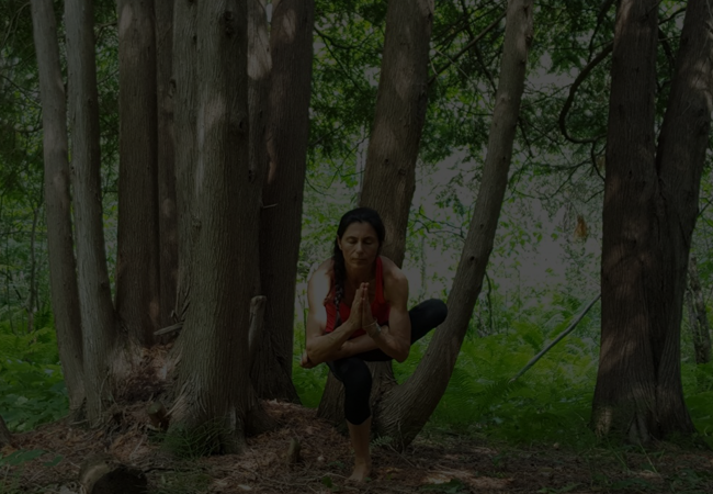
With Hockley Yoga Hikes you’ll be hiking to conservation parks and natural hiking trails and areas around the Orangeville; mostly Hockley Valley Nature Reserve and Mono Provincial Park locations, within an hour away from Toronto; closer if you live in the area. Meet up time and location is usually at the Hockley Valley Provincial Park Parking lot, located right off Hockley Road 7; close to the Hockley Valley Resort and it will be arranged ahead of each hike. For more information please contact us directly.
Below there is a description of the areas where most of our hiking will take place in :

Bruce Trail hike –

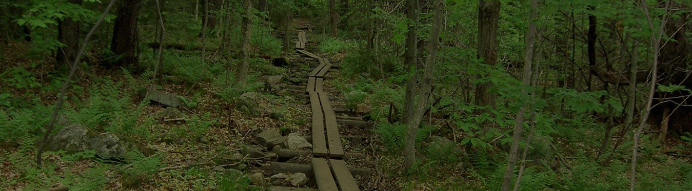
Hockley Valley Provincial Nature Reserve & Tom East Side Trail and Glen Cross Side Trail
The Hockley Valley, just north-east of Orangeville, Ontario, is a beautiful area, and right in the centre is the Hockley Valley Provincial Nature Reserve. The hike offers lots of rolling hills, a varied forest, and ravines with rivers and bridges. This hike has the main Bruce Trail as its backbone, with a number of side-trails to reduce the amount of duplication.

Enter the Bruce Trail on the North side of Hockley Road. In just a few hundred metres, the Tom East SideTrail goes straight ahead while the main trail turns left climbing a steep incline to a lookout point. The trail enters a hardwood bush which emerges into a trail corridor parrallel to the Nottawasaga River. The main trail passes the point where the Tom East Side trail rejoins it and continues to the left crossing a branch of the Nottawasaga River on a series of three bridges.T he trail climbs to the top of a hill winding around the ridge as it crosses another stream.

At the top of the ridge the Glen Cross Side Trail goes off to the right while the main trail continues to the left winding through wooded hills, crossing a large stream and climbing to the northern part of the park.

The trail winds through hardwood bush and follows an old logging track. Tom East was the President of the Caledon Hills Bruce Trail Club from 1965 to 1969, and later the President of the Bruce Trail Association. He laid out much of the Bruce Trail in the Caledon Hills section in the 1960s, and today we all benefit from those early volunteer efforts. With file information from the Bruce Trail, for more information on this and other Bruce trails please purchase the Bruce Trail map and trail guidebook. The Bruce Trail is the oldest and longest marked hiking trail in Canada. It is 840 km long, with over 440 km of side trails. Every year more than 400,000 visits are made to the Trail as people walk, snowshoe, watch wildlife, take photographs and admire the glorious scenery of the Escarpment.

The Bruce Trail was instrumental in the Escarpment being named a UNESCO World Biosphere Reserve by the United Nations in 1990 – one of only twelve such reserves in all of Canada.

Location and details of the hike:

General Location: Just north-east of Orangeville
Bruce Trail Reference 20.0 Start Map #19 Mono Centre Caledon Hills section
Total Bruce Trail Distance 4.4 km (km 76.4 to km 80.8)
Tom East Side Trail Distance 2.3 km
Glen Cross Side Trail Distance 4.0 km
Close by : Snell Loop

Directions to the starting point of the hike:

1. Take the 401 West from Toronto to Hwy 410 north (exit 344)

2. Continue to the end of Hwy 410 where it turns into Hwy 10 north

3. Continue north on Hwy 10, through Orangeville

4. Turn right on Hockley Road / County Road 7

5. Watch for the parking lot and Hockley Valley sign on the left / north side of the road about 5 km from Hwy 10.

 Bruce Trail

 Bruce Trail

Hike details

There are a few side trails here, so you can choose how far you want to hike, but I’ll describe:

1. short section north on the main trail

2. Tom East Side Trail counter clockwise

3. section on the main trail north

4. Glen Cross Side Trail clockwise

5. south all the way back to the start

Owned and managed by the Ministry of Natural Resources, this park of over 1,300 acres is home to many rare plants. Consequently, activities are strictly controlled, as set out in the recently completed Management Plan. Situated in the Second and Third concessions EHS between the hamlet of Mono Centre and the Twenty-Five Side Road, the park encompasses part of the Niagara Escarpment. The entrance to the park is on the Third Line EHS between the Mono Centre Road and the 25 Side Road. Hiking (Bruce Trail) and cross-country ski trails are well-maintained in terrain which is spectacular year round.

 Mono Cliffs

Mono Cliffs Provincial Park

 Bruce Trail

Island Lake Conservation Area

Island Lake Conservation Area – Over 670 acres of conservation land, including the lake, with access from Hurontario Street North of Buena Vista Drive.

 Bruce Trail

 Bruce Trail

*Embrace Your Peace This Season - Inquire About Your Options In-Person & Online
Individual Wellness Coaching & Private Yoga Sessions